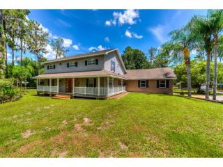
Cost estimate history
| Year | Tax | Assessment | Market |
|---|---|---|---|
| 2013 | $2,777 | $208,234 | $208,234 |
Market Activities
Britt Rd Fire Incident History
To date, we have no information about fire incidents in 2024
09 Sep 2019
Brush, or brush and grass mixture fire
Property Use —
Open land or field
Area of Origin —
Wildland, woods
First Ignition —
Light vegetation - not crop, including grass
Heat Source —
Lightning
09 May 2019
Grass fire
Property Use —
Open land or field
Area of Origin —
Wildland, woods
First Ignition —
Light vegetation - not crop, including grass
Heat Source —
Heat spread from another fire, other
Britt Rd Incidents registered in FEMA
(Federal Emergency Management Agency)
To date, we have no information about incidents registered in FEMA in 2024
23 Sep 2005
Authorized controlled burning
Property Use —
1 or 2 family dwelling
10 Nov 2003
Rescue, emergency medical call (EMS) call, other
Property Use —
1 or 2 family dwelling
15 Sep 2003
False alarm or false call, other
Property Use —
1 or 2 family dwelling
Properties Nearby
| Street Address | Residens/Landlords | |
|---|---|---|
12205 Britt Rd, Parrish, FL 34219-8618 Single Family
|
Earl Baker, Norma Baker | |
12225 Britt Rd, Parrish, FL 34219-8618 Single Family Residential
|
Kimberly Meyers, Leslie Meyers |

