Cost estimate history
| Year | Tax | Assessment | Market |
|---|---|---|---|
| 2013 | $952 | $41,410 | N/A |
| 2012 | N/A | N/A | $118,300 |
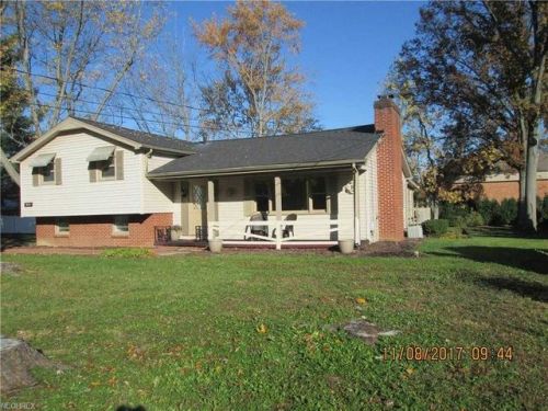
Market Activities
To date, we have no information about market activities in 2025
Jan 2018
Sold
Nearwood St Fire Incident History
To date, we have no information about fire incidents in 2025
29 Oct 2010
Brush, or brush and grass mixture fire
Property Use —
1 or 2 family dwelling
Area of Origin —
Outside area, other
First Ignition —
Light vegetation - not crop, including grass
29 Oct 2010
Brush, or brush and grass mixture fire
Property Use —
1 or 2 family dwelling
Area of Origin —
Outside area, other
First Ignition —
Light vegetation - not crop, including grass
Heat Source —
Match
30 May 1999
Mobile property (vehicle) fire, other
Property Use —
Residential street, road or residential driveway
Area of Origin —
Separate operator/control area of transportation
8515 Nearwood St incidents registered in FEMA
(Federal Emergency Management Agency)
To date, we have no information about incidents registered in FEMA in 2025
08 Jun 2002
EMS call, excluding vehicle accident with injury
Property Use —
1 or 2 family dwelling
04 Jan 2002
EMS call, excluding vehicle accident with injury
Property Use —
1 or 2 family dwelling
Nearwood St Incidents registered in FEMA
(Federal Emergency Management Agency)
To date, we have no information about incidents registered in FEMA in 2025
22 Oct 2011
Unauthorized burning
Property Use —
Graded and cared-for plots of land
15 Jul 2005
Trash or rubbish fire, contained
Property Use —
1 or 2 family dwelling
11 Jun 2003
EMS call, excluding vehicle accident with injury
Property Use —
1 or 2 family dwelling
13 Aug 2002
EMS call, excluding vehicle accident with injury
Property Use —
1 or 2 family dwelling
Properties Nearby
| Street Address | Residens/Landlords | |
|---|---|---|
| Jason Lewis Allen | ||
| Helene R Page |