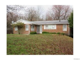
Cost estimate history
| Year | Tax | Assessment | Market |
|---|---|---|---|
| 2014 | N/A | $94,900 | $130,900 |
Market Activities
Lt Brender Hwy Fire Incident History
To date, we have no information about fire incidents in 2025
31 May 2002
Cultivated vegetation, crop fire, other
Property Use —
1 or 2 family dwelling
Area of Origin —
Courtyard, patio, porch, terrace
Heat Source —
Spark, ember or flame from operating equipment
431 Lt Brender Hwy incidents registered in FEMA
(Federal Emergency Management Agency)
To date, we have no information about incidents registered in FEMA in 2025
09 Sep 2002
System malfunction, other
Lt Brender Hwy Incidents registered in FEMA
(Federal Emergency Management Agency)
To date, we have no information about incidents registered in FEMA in 2025
18 Jan 2004
Carbon monoxide incident
Property Use —
1 or 2 family dwelling
18 Sep 2002
Unintentional transmission of alarm, other
16 Sep 2002
Good intent call, other
09 Sep 2002
System malfunction, other
Properties Nearby
| Street Address | Residens/Landlords | |
|---|---|---|
114 Lt Brender Hwy, Ferndale, NY 12734-5138 Unspecified
|
John R Maxwell, Virginia Maxwell | |
165 Lt Brender Hwy, Ferndale, NY 12734-5139 Single Family Residential
|
||
359 Lt Brender Hwy, Ferndale, NY 12734-5403 Unspecified
|
Dawn Quinn |