Purchase History
| Date | Event | Price | Source | Agents |
|---|---|---|---|---|
| 09/25/2014 | Sold | $140,000 | Public records | |
| 04/29/2014 | Sold | $99,000 | Public records | |
| 03/10/2009 | Sold | $73,500 | Public records | |
| 07/16/2008 | Sold | $189,000 | Public records | |
| 12/21/2006 | Sold | $290,000 | Public records | |
| 11/16/2006 | Sold | $4,500 | Public records | |
| 07/08/2005 | Sold | $350,000 | Public records | |
| 08/28/2002 | Sold | $50,000 | Public records |
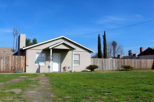
PURCHASE HISTORY 767 South Ave, Turlock CA
Cost estimate history
| Year | Tax | Assessment | Market |
|---|---|---|---|
| 2014 | $845 | $76,946 | N/A |
Market Activities
South Ave Fire Incident History
To date, we have no information about fire incidents in 2025
29 Jun 2017
Cooking fire, confined to container
Property Use —
Multifamily dwellings
Area of Origin —
Cooking area, kitchen
First Ignition —
Household utensils
Heat Source —
Radiated, conducted heat from operating equipment
21 Dec 2014
Passenger vehicle fire
Property Use —
Residential street, road or residential driveway
Area of Origin —
Operator/passenger area of transportation equip.
19 Sep 2012
Passenger vehicle fire
Property Use —
Residential street, road or residential driveway
Area of Origin —
Operator/passenger area of transportation equip.
06 Jul 2011
Grass fire
Property Use —
Open land or field
Ave Incidents registered in FEMA
(Federal Emergency Management Agency)
To date, we have no information about incidents registered in FEMA in 2025
15 Dec 2012
Unauthorized burning
Property Use —
Open land or field
08 Apr 2011
Unauthorized burning
Property Use —
1 or 2 family dwelling
31 Jan 2009
Unauthorized burning
Property Use —
1 or 2 family dwelling
06 Jul 2008
Gas leak (natural gas or LPG)
Property Use —
1 or 2 family dwelling
Properties Nearby
| Street Address | Residens/Landlords | |
|---|---|---|
718 Ave, Turlock, CA 95380-5610 Single Family Residential
|
Michelle L Adney, Ester Maldonado | |
719 Ave, Turlock, CA 95380-5678 Multi-Family Home
|
Eric Chipponeri, Randall L Davis | |
721 Ave, Turlock, CA 95380-5609 Single Family Residential
|
Charles J Shackelford, Gary Shackelford | |
734 Ave, Turlock, CA 95380-5610 Single Family Residential
|
Maria H Dutra | |
760 Ave, Turlock, CA 95380-5610 Single Family Residential
|
Armondo M Andre, Frank M Cabral |