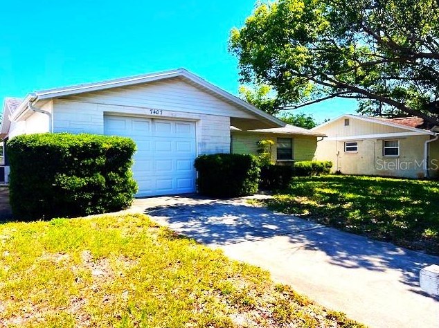

Cost estimate history
| Year | Tax | Assessment | Market |
|---|---|---|---|
| 2014 | $486 | N/A | N/A |
| 2013 | N/A | $45,140 | N/A |
Market Activities
Sandalwood Dr Fire Incident History
To date, we have no information about fire incidents in 2025
04 Nov 2007
Passenger vehicle fire
Property Use —
Residential street, road or residential driveway
Area of Origin —
Vehicle area, other
First Ignition —
Electrical wire, cable insulation
02 Jan 2006
Brush, or brush and grass mixture fire
Property Use —
Open land or field
Area of Origin —
Open area - outside; included are farmland, field
First Ignition —
Heavy vegetation - not crop, including trees
Heat Source —
Explosive, fireworks, other
06 Jul 2004
Brush, or brush and grass mixture fire
Property Use —
Open land or field
Area of Origin —
Open area - outside; included are farmland, field
First Ignition —
Heavy vegetation - not crop, including trees
Sandalwood Dr Incidents registered in FEMA
(Federal Emergency Management Agency)
To date, we have no information about incidents registered in FEMA in 2025
06 Jul 2015
Unauthorized burning
Property Use —
Graded and cared-for plots of land
19 Apr 2015
Unauthorized burning
Property Use —
Graded and cared-for plots of land
19 Dec 2014
Unauthorized burning
Property Use —
Vehicle parking area
09 Mar 2008
Vehicle accident, general cleanup
Property Use —
Street, other
Properties Nearby
| Street Address | Residens/Landlords |
|---|