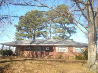
Cost estimate history
| Year | Tax | Assessment | Market |
|---|---|---|---|
| 2013 | N/A | $21,400 | $85,600 |
| 2011 | $355 | N/A | N/A |
Market Activities
Mckinstry Rd Fire Incident History
To date, we have no information about fire incidents in 2025
23 Mar 2019
Grass fire
Property Use —
Graded and cared-for plots of land
Area of Origin —
Open area - outside; included are farmland, field
First Ignition —
Light vegetation - not crop, including grass
Heat Source —
Flying brand, ember, spark
09 May 2016
Brush, or brush and grass mixture fire
Property Use —
Open land or field
Area of Origin —
Open area - outside; included are farmland, field
First Ignition —
Light vegetation - not crop, including grass
Heat Source —
Flying brand, ember, spark
07 Aug 2013
Off-road vehicle or heavy equipment fire
Property Use —
Open land or field
Area of Origin —
Engine area, running gear, wheel area
Heat Source —
Radiated, conducted heat from operating equipment
28 Sep 2012
Brush, or brush and grass mixture fire
Property Use —
Open land or field
Area of Origin —
Wildland, woods
First Ignition —
Heavy vegetation - not crop, including trees
Mckinstry Rd Incidents registered in FEMA
(Federal Emergency Management Agency)
To date, we have no information about incidents registered in FEMA in 2025
25 Jun 2006
Brush, or brush and grass mixture fire
25 Jun 2006
Outside rubbish, trash or waste fire
Property Use —
Outside or special property, other
04 Nov 2000
System malfunction, other
Property Use —
1 or 2 family dwelling
06 Mar 2000
Natural vegetation fire, other
Property Use —
Open land or field
Properties Nearby
| Street Address | Residens/Landlords |
|---|