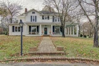
Cost estimate history
| Year | Tax | Assessment | Market |
|---|---|---|---|
| 2013 | N/A | $44,650 | $178,600 |
| 2010 | $2,185 | N/A | N/A |
Market Activities
Cornersville Rd Fire Incident History
To date, we have no information about fire incidents in 2025
11 Jul 2018
Brush, or brush and grass mixture fire
Property Use —
1 or 2 family dwelling
Area of Origin —
Wildland, woods
First Ignition —
Chips, including wood chips
25 Apr 2013
Mobile property (vehicle) fire, other
Property Use —
Graded and cared-for plots of land
Area of Origin —
Engine area, running gear, wheel area
First Ignition —
Flammable liquid/gas - in/from engine or burner
Heat Source —
Backfire from internal combustion engine
13 Dec 2008
Building fires
Property Use —
Convenience store
Area of Origin —
Egress/exit, other
21 Jun 2008
Grass fire
Property Use —
Street or road in commercial area
Area of Origin —
Open area - outside; included are farmland, field
First Ignition —
Light vegetation - not crop, including grass
Heat Source —
Cigarette
Cornersville Rd Incidents registered in FEMA
(Federal Emergency Management Agency)
To date, we have no information about incidents registered in FEMA in 2025
11 Sep 2015
Biological hazard, confirmed or suspected
Property Use —
Vehicle parking area
29 Jun 2013
Dumpster or other outside trash receptacle fire
Property Use —
Multifamily dwellings
21 Apr 2013
Authorized controlled burning
Property Use —
Residential, other
17 Feb 2013
Unauthorized burning
Property Use —
Open land or field
Properties Nearby
| Street Address | Residens/Landlords | |
|---|---|---|
450 Cornersville Rd, Lewisburg, TN 37091-2786 Single Family Residential
|
Christine Highland, David Highland | |
508 Cornersville Rd, Lewisburg, TN 37091-4111 Single Family Residential
|
1500 Acres Baymar Farm LP, Mary A Ehrlich | |
633 Cornersville Rd, Lewisburg, TN 37091-4113 Single Family Residential
|
Melinda Curran | |
638 Cornersville Rd, Lewisburg, TN 37091-4143 Single Family Residential
|
Janice Holley Dunaway, Larry P Dunaway |