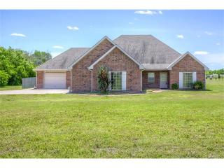
Purchase History
| Date | Event | Price | Source | Agents |
|---|---|---|---|---|
| 02/11/2010 | Sold | $220,000 | Public records | |
| 07/09/2009 | Sold | $189,605 | Public records |
Cost estimate history
| Year | Tax | Assessment | Market |
|---|---|---|---|
| 2014 | $2,733 | N/A | N/A |
| 2013 | N/A | $27,163 | $226,352 |
Market Activities
To date, we have no information about market activities in 2025
Jul 2016
Listed for sale
Jun 2016
Sold
Apr 2016
Sold
2400 Rd Fire Incident History
To date, we have no information about fire incidents in 2025
27 Apr 2016
Fire in mobile prop. used as a fixed struc., other
Property Use —
Mercantile, business, other
Area of Origin —
Roof surface: exterior
First Ignition —
Structural component or finish, other
Heat Source —
Lightning
27 Feb 2016
Grass fire
Property Use —
Open land or field
Area of Origin —
Open area - outside; included are farmland, field
First Ignition —
Light vegetation - not crop, including grass
Heat Source —
Multiple heat sources including multiple ignitions
26 Feb 2016
Building fires
Property Use —
Residential, other
Area of Origin —
Wall assembly
First Ignition —
Interior wall covering excluding drapes, etc.
Heat Source —
Heat from direct flame, convection currents
18 Feb 2016
Grass fire
Property Use —
Open land or field
Area of Origin —
Open area - outside; included are farmland, field
First Ignition —
Light vegetation - not crop, including grass
Heat Source —
Flying brand, ember, spark
2400 Incidents registered in FEMA
(Federal Emergency Management Agency)
To date, we have no information about incidents registered in FEMA in 2025
16 Apr 2015
Power line down
Property Use —
Highway or divided highway
07 May 2014
Authorized controlled burning
Property Use —
Open land or field
18 Oct 2013
Gas leak (natural gas or LPG)
Property Use —
Open land or field
01 Jun 2013
Gas leak (natural gas or LPG)
Property Use —
Open land or field
Properties Nearby
| Street Address | Residens/Landlords |
|---|
