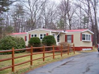
Cost estimate history
| Year | Tax | Assessment | Market |
|---|---|---|---|
| 2012 | $2,237 | $79,900 | N/A |
Market Activities
Cross Mill Rd Fire Incident History
To date, we have no information about fire incidents in 2025
15 Mar 2006
Brush, or brush and grass mixture fire
Property Use —
Open land or field
Area of Origin —
Wildland, woods
First Ignition —
Heavy vegetation - not crop, including trees
21 Dec 2004
Building fires
Property Use —
1 or 2 family dwelling
Area of Origin —
Ceiling & floor assembly, crawl space b/t stories
First Ignition —
Mattress, pillow
Heat Source —
Cigarette lighter
15 Mar 2004
Trash or rubbish fire, contained
Property Use —
1 or 2 family dwelling
First Ignition —
Rubbish, trash, or waste
Heat Source —
Hot ember or ash
Cross Ml Rd Incidents registered in FEMA
(Federal Emergency Management Agency)
To date, we have no information about incidents registered in FEMA in 2025
22 Dec 2015
Authorized controlled burning
Property Use —
1 or 2 family dwelling
19 May 2015
Unauthorized burning
Property Use —
1 or 2 family dwelling
27 Apr 2015
Authorized controlled burning
Property Use —
Graded and cared-for plots of land
30 Mar 2015
Authorized controlled burning
Property Use —
1 or 2 family dwelling
Properties Nearby
| Street Address | Residens/Landlords |
|---|