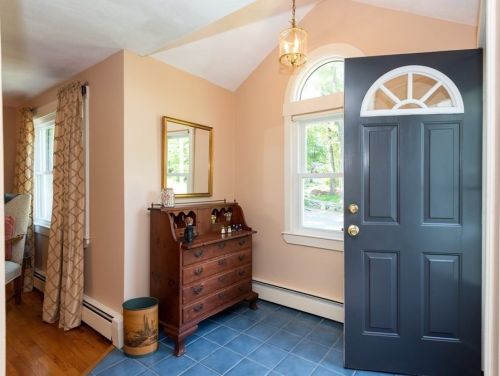
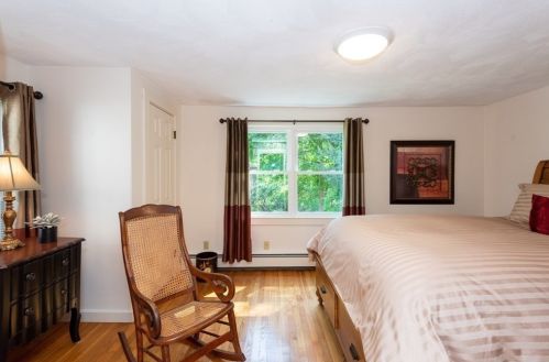
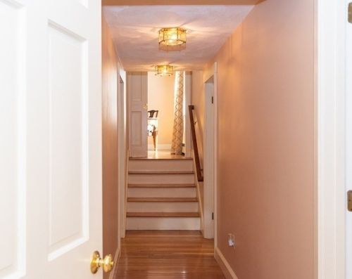
23 Gail St Topsfield, MA 01983 / 1728

Residence for Single Family

(UPDATED: 07/09/2025)
  • 3 Beds
  • 2 Baths
  • 1.762 square feet
Sold Jul 2021
$729,000
Property Report

Information about property on 23 Gail St, Topsfield MA, 01983-1728. Find out owner contacts, building history, price, neighborhood at Homemetry Address Directory.

Property Details

This approximately eighteen hundred square feet property with FIVE rooms including three bedrooms and two and half bathrooms was built in the fifties on 1,19 acres.

Facts

  • Built in 1951
  • Lot size 1,19 acres
  • Floor size 1,762 sqft
  • Rooms 5
  • Bedrooms 3
  • Bathrooms 2,5
  • Stories 1
  • Heating & Cooling
  • Heat type Other
  • Exterior Home Features
  • Exterior material Wood
  • Roof type Asphalt

Listing info

  • Last sold Oct 1984 for $106,000

Householders and Tenants for 23 Gail St, Topsfield MA

Possible residents contact details

Person Name Phone Number Additional Info
Andrew Merrill
978-887-****
Jean Merrill
Leslie J Merrill Age: 71
978-887-****
Residential status:
Homeowner
Job:
Service Occupations
William G Merrill Age: 77
978-887-****

Where is 23 Gail St, Topsfield MA located on map?

Market Activities

To date, we have no information about market activities in 2025
Jul 2021 Sold
23 Gail St
Price history :
  • Single Family
  • 2,200 sqft
  • 3 beds
  • 3 baths
May 2021 Sold
23 Gail St
Price history :
  • Single Family
  • 2,200 sqft
  • 3 beds
  • 3 baths

View more

Gail St Fire Incident History

To date, we have no information about fire incidents in 2025
02 Sep 2016 Natural vegetation fire, other
Property Use —
1 or 2 family dwelling
Area of Origin —
Outside area, other
First Ignition —
Light vegetation - not crop, including grass
02 Nov 2012 Building fires
Property Use —
1 or 2 family dwelling
Area of Origin —
Heating room or area, water heater area
First Ignition —
Flammable liquid/gas - in/from final container
Heat Source —
Spark, ember or flame from operating equipment
20 Apr 2012 Brush, or brush and grass mixture fire
Property Use —
1 or 2 family dwelling
Area of Origin —
Open area - outside; included are farmland, field
First Ignition —
Light vegetation - not crop, including grass
Heat Source —
Hot ember or ash

Gail St Incidents registered in FEMA
(Federal Emergency Management Agency)

To date, we have no information about incidents registered in FEMA in 2025
29 Jun 2015 Arcing, shorted electrical equipment
Property Use —
1 or 2 family dwelling
20 Mar 2012 Unauthorized burning
Property Use —
1 or 2 family dwelling
28 Sep 2010 Power line down
Property Use —
1 or 2 family dwelling
25 Mar 2004 Cooking fire, confined to container
Property Use —
1 or 2 family dwelling

View more

Properties Nearby

Street AddressResidens/Landlords
11 Gail St, Topsfield, MA 01983-1701
Single Family
  • 3 beds
  • 2 baths
  • 1,788 sqft
  • Built in 1942
Christopher B Galat, Rebecca F Hathaway
12 Gail St, Topsfield, MA 01983-1730
Single Family
  • 2 beds
  • 2 baths
  • 1,944 sqft
  • Built in 1934
Charles R Denault, Laura F Denault
17 Gail St, Topsfield, MA 01983-1701
Single Family
  • 2 beds
  • 1 bath
  • 782 sqft
  • Built in 1946
Julia B Fischer, M P Fischer
18 Gail St, Topsfield, MA 01983-1730
Single Family
  • 3 beds
  • 1 bath
  • 1,072 sqft
  • Built in 1970
Jason M Santosuosso, SANTOSUOSSO CONSTRUCTION
19 Gail St, Topsfield, MA 01983-1728
Single Family
  • 3 beds
  • 1.5 baths
  • 1,440 sqft
  • Built in 1946
Brian Conwell, R Demarco
25 Gail St, Topsfield, MA 01983-1728
Single Family
  • 3 beds
  • 1 bath
  • 1,228 sqft
  • Built in 1946
Grace E Maclean, Heidi B Sturgis
 

FAQ about the house at 23 Gail St, Topsfield, MA


NOTICE: You may not use SpamRoom or the information it provides to make decisions about employment, credit, housing or any other purpose that would require Fair Credit Reporting Act (FCRA) compliance. SpamRoom is not a Consumer Reporting Agency (CRA) as defined by the FCRA and does not provide consumer reports.