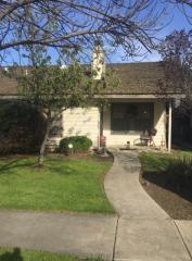
Purchase History
| Date | Event | Price | Source | Agents |
|---|---|---|---|---|
| 10/30/2002 | Sold | $82,500 | Public records |
Cost estimate history
| Year | Tax | Assessment | Market |
|---|---|---|---|
| 2014 | $1,111 | $97,476 | N/A |
Market Activities
10th Ave Fire Incident History
To date, we have no information about fire incidents in 2025
19 Sep 2019
Outside rubbish, trash or waste fire
Property Use —
Graded and cared-for plots of land
Area of Origin —
Open area - outside; included are farmland, field
First Ignition —
Organic materials, other
Heat Source —
Chemical reaction
17 Aug 2019
Trash or rubbish fire, contained
Property Use —
Food and beverage sales, grocery store
First Ignition —
Rubbish, trash, or waste
04 Jul 2019
Grass fire
Property Use —
Vacant lot
Area of Origin —
Open area - outside; included are farmland, field
First Ignition —
Light vegetation - not crop, including grass
Heat Source —
Fireworks
04 Dec 2018
Off-road vehicle or heavy equipment fire
Property Use —
Vehicle parking area
Area of Origin —
Engine area, running gear, wheel area
10th Ave Incidents registered in FEMA
(Federal Emergency Management Agency)
To date, we have no information about incidents registered in FEMA in 2025
25 Nov 2015
Authorized controlled burning
Property Use —
1 or 2 family dwelling
23 Nov 2015
Unauthorized burning
Property Use —
1 or 2 family dwelling
24 Oct 2015
Building fires
Property Use —
1 or 2 family dwelling
27 Sep 2015
Unauthorized burning
Property Use —
1 or 2 family dwelling
Properties Nearby
| Street Address | Residens/Landlords | |
|---|---|---|
417 10 Ave, Hanford, CA 93230-4129 Single Family Residential
|
Michael Scott Ioane, Rachel O Moreno |