
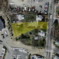
Cost estimate history
| Year | Assessment | ||
|---|---|---|---|
| 2016 | $54,900 | ||
| 2015 | $53,800 | ||
| 2014 | $51,200 | ||
| 2013 | $51,200 | ||
| 2012 | $51,200 | ||
| 2011 | $50,000 | ||
| 2010 | $50,000 | ||
| 2009 | $50,000 | ||
| 2008 | $50,000 | ||
| 2007 | $68,900 | ||
| 2006 | $68,900 | ||
| 2005 | $68,900 | ||
| 2004 | $38,500 | ||
| 2003 | $38,500 | ||
| 2002 | $38,500 | ||
| 2001 | $38,500 | ||
| 2000 | $38,500 | ||
| 1999 | $38,500 | ||
| 1998 | $29,400 | ||
| 1997 | $29,400 | ||
| 1996 | $29,400 | ||
| 1995 | $31,400 | ||
| 1994 | $31,400 | ||
| 1993 | $31,400 | ||
| 1992 | $35,600 |
Lexington St Fire Incident History
To date, we have no information about fire incidents in 2025
15 May 2018
Grass fire
Property Use —
Residential street, road or residential driveway
Area of Origin —
Outside area, other
First Ignition —
Chips, including wood chips
Heat Source —
Cigarette
04 Jul 2016
Brush, or brush and grass mixture fire
Property Use —
Open land or field
Area of Origin —
Outside area, other
First Ignition —
Heavy vegetation - not crop, including trees
Heat Source —
Explosive, fireworks, other
29 Apr 2013
Building fires
Property Use —
1 or 2 family dwelling
Area of Origin —
Cooking area, kitchen
First Ignition —
Cooking materials, including edible materials
Heat Source —
Heat from direct flame, convection currents
01 Apr 2013
Building fires
Property Use —
Multifamily dwellings
Area of Origin —
Cooking area, kitchen
First Ignition —
Item First Ignited, Other
Heat Source —
Heat from powered equipment, other
Lexington St Incidents registered in FEMA
(Federal Emergency Management Agency)
To date, we have no information about incidents registered in FEMA in 2025
11 Oct 2014
Vehicle accident, general cleanup
Property Use —
Street, other
11 Jul 2014
Cooking fire, confined to container
Property Use —
Multifamily dwellings
29 Jun 2014
Gas leak (natural gas or LPG)
Property Use —
Business office
21 Nov 2013
Vehicle accident, general cleanup
Property Use —
Street, other
Properties Nearby
| Street Address | Residens/Landlords | |
|---|---|---|
11 Lexington St, Newton, MA 02465-1029 Parking Lots
|
||
14 Lexington St, Newton, MA 02465-1030 Two Family
|
Kit Transue, Christophe A Transue | |
49 Lexington St, Newton, MA 02465-1062 General Office Bldg.
|
Alliance Human Services, Inc, Alliance of The Chesapeake Bay, Inc | |
71 Lexington St, Newton, MA 02466-1345 General Office Bldg.
|
||
89 Lexington St, Newton, MA 02466-1347 High Rise |
John L Matthews, Frank R Gorgone | |
92 Lexington St, Newton, MA 02466-1346 Single Family
|
Regina Farnese, Robert J Farnese | |
211 Lexington St, Newton, MA 02466-1208 Municipal Improved
|