


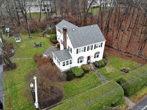
Cost estimate history
| Year | Tax | Assessment | Market |
|---|---|---|---|
| 2014 | $10,109 | $433,680 | N/A |
Market Activities
To date, we have no information about market activities in 2025
Feb 2023
Sold
Jan 2023
Sold
Feb 2018
Sold
Riverbank Rd Fire Incident History
To date, we have no information about fire incidents in 2025
26 Mar 2018
Brush, or brush and grass mixture fire
Property Use —
Open land or field
Area of Origin —
Open area - outside; included are farmland, field
First Ignition —
Heavy vegetation - not crop, including trees
Heat Source —
Match
14 Jan 2018
Brush, or brush and grass mixture fire
Area of Origin —
Outside area, other
06 Dec 2016
Fires in structures other than in a building
Property Use —
1 or 2 family dwelling
Area of Origin —
Cooking area, kitchen
07 Dec 2007
Natural vegetation fire, other
Property Use —
Residential street, road or residential driveway
Area of Origin —
Highway, parking lot, street: on or near
First Ignition —
Light vegetation - not crop, including grass
Riverbank Rd Incidents registered in FEMA
(Federal Emergency Management Agency)
To date, we have no information about incidents registered in FEMA in 2025
09 Aug 2015
Unauthorized burning
Property Use —
Open land or field
09 Jul 2015
Power line down
Property Use —
Residential street, road or residential driveway
17 Aug 2014
Unauthorized burning
Property Use —
Open land or field
06 Aug 2014
Unauthorized burning
Property Use —
Open land or field
Properties Nearby
| Street Address | Residens/Landlords | |
|---|---|---|
147 Riverbank Rd, Stamford, CT 06903-3700 Single Family Residential
|
Julie Beddall, Juliette R Beddall |