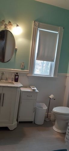
122 Dale St Dedham, MA 02026 / 3429

Residence for Single Family

(UPDATED: 07/16/2025)
  • 3 Beds
  • 2 Baths
  • 2.052 square feet
Sold Jul 2021
$685,000
Property Report

Information about property on 122 Dale St, Dedham MA, 02026-3429. Find out owner contacts, building history, price, neighborhood at Homemetry Address Directory.

Property Details

A big two-story multi-family estate at 122 Dale St, Dedham, MA.

Facts

  • Built in 1880
  • Lot size 8,500 sqft
  • Floor size 2,052 sqft
  • Bedrooms 3
  • Stories 2
  • Heating & Cooling
  • Heat type Other
  • Exterior Home Features
  • Exterior material Wood
  • Roof type Asphalt

Listing info

  • Last sold Mar 2002 for $180,000

Householders and Tenants for 122 Dale St, Dedham MA

Possible residents contact details

Person Name Phone Number Additional Info
Eric M Siegel Age: 42
781-326-****
Residential status:
Homeowner
Helen M Kamps Age: 110
781-326-****
Kimberly A Burr
781-381-****
Kimberly Durkin Age: 54
781-381-****
Leah Siegel
Residential status:
Homeowner
Job:
Service Occupations
Margaret Mccarthy
781-727-****
Residential status:
Renter
Job:
Transportation and Material Moving Occupations
Nancy Siegel
Residential status:
Homeowner
Job:
Service Occupations
Peggy M Mccarthy
781-461-****
V Durkin
781-381-****

Where is 122 Dale St, Dedham MA located on map?

Market Activities

To date, we have no information about market activities in 2025
Jul 2021 Sold
122 Dale St
Price history :
  • Multi-Family
  • 8,712 sqft
  • 5 beds
  • 3 baths
Apr 2021 Sold
122 Dale St
Price history :
  • Multi-Family
  • 8,712 sqft
  • 5 beds
  • 3 baths

View more

Dale St Fire Incident History

To date, we have no information about fire incidents in 2025
04 Mar 2009 Building fires
Property Use —
1 or 2 family dwelling
Area of Origin —
Courtyard, patio, porch, terrace
First Ignition —
Upholstered sofa, chair, vehicle seats
Heat Source —
Hot ember or ash

122 Dl St incidents registered in FEMA
(Federal Emergency Management Agency)

To date, we have no information about incidents registered in FEMA in 2025
31 Oct 2011 Power line down
Property Use —
Residential street, road or residential driveway

Dl St Incidents registered in FEMA
(Federal Emergency Management Agency)

To date, we have no information about incidents registered in FEMA in 2025
30 Sep 2015 Power line down
Property Use —
Residential street, road or residential driveway
07 Jan 2015 Oil or other combustible liquid spill
Property Use —
1 or 2 family dwelling
20 Aug 2014 Power line down
Property Use —
Residential street, road or residential driveway
13 Aug 2014 Power line down
Property Use —
Street, other

View more

Properties Nearby

Street AddressResidens/Landlords
102 Dl St, Dedham, MA 02026-3430
Single Family
  • 3 beds
  • 2.5 baths
  • 1,317 sqft
  • Built in 1940
TULACH ARD INC, Lauren M Broderick
103 Dl St, Dedham, MA 02026-3428
Single Family
  • 3 beds
  • 1 bath
  • 1,284 sqft
  • Built in 1900
Alan Anderson Construction, Alan W Anderson
108 Dl St, Dedham, MA 02026-3430
Single Family Residential
  • 4 beds
  • 1 bath
  • Lot: 6,659 sqft
  • Built in 1967
Brianne Carabia, Robert A Carabia
 

FAQ about the house at 122 Dl St, Dedham, MA


NOTICE: You may not use SpamRoom or the information it provides to make decisions about employment, credit, housing or any other purpose that would require Fair Credit Reporting Act (FCRA) compliance. SpamRoom is not a Consumer Reporting Agency (CRA) as defined by the FCRA and does not provide consumer reports.